The Ridgeway Map Booklet: 1:25,000 OS Route MappingAuthor :
Paperback
Published : Monday 21 November 2016
You may also like ...

by
Paperback
21 Nov 2016
>>
€19.83
Extended stock – Dispatch 5-7 days
by
Paperback
21 Nov 2016
>>
€9.30
Extended stock – Dispatch 5-7 days

by
Paperback
13 Feb 2020
>>
€15.15
Extended stock – Dispatch 5-7 days

by
Paperback
01 Nov 2013
>>
€19.88
Extended stock – Dispatch 5-7 days
Description
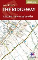
Map of the 87 mile (139km) Ridgeway National Trail through the south of England from Avebury in Wiltshire to Ivinghoe Beacon in Buckinghamshire. This booklet is included with the Cicerone guidebook to the trail, and shows the full route on Ordnance Survey 1:25,000 maps. Presented in 12 stages in the guidebook, the trail typically takes 6-8 days.
All the mapping you need to walk the Ridgeway National Trail an 87-mile (139km) route through southern England from Avebury in Wiltshire to Ivinghoe Beacon in Buckinghamshire. Following a ridge of chalk hills through the Chiltern Hills AONB and North Wessex Downs AONB, the Ridgeway is usually completed over 6-8 days and can be walked all year round. NOTE An accompanying Cicerone guidebook - The Ridgeway - describes the full route with lots of other practical information. The Cicerone guidebook INCLUDES a copy of this map booklet. This booklet of Ordnance Survey 1:25,000 Explorer maps shows the full line of the National Trail, along with the relevant extract from the OS Explorer map legend. It can be used when walking the trail in either direction, and is just the right size for slipping into a jacket pocket or top of a rucksack.
Reviews